Town Planning ( TP ) Map in Dholera
The "Town Planning Map in Dholera" is a crucial tool for understanding and navigating the development plans of Dholera Smart City, one of India's most ambitious urban projects. This comprehensive TP Map in Dholera outlines the structured growth of the city, providing a detailed layout of residential, commercial, and industrial zones. The map highlights key infrastructure components such as roads, parks, and public amenities, ensuring that both investors and residents can make informed decisions about their future in this rapidly evolving urban landscape.
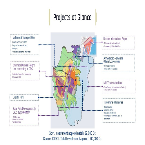
Town Planning Scheme of Dholera as getting finalised under linear scheme where in both sides of new expressway development possession and development permissions will be given. To visualise how it will be we can see activation zone as sample development. Same will be visible in coming years on the both side of expressway as linear development in sub town planning ( TP ) schemes declared.
With its clear demarcation of land use and strategic planning, the Town Planning Map in Dholera serves as a blueprint for the city's development, reflecting the vision of creating a modern, sustainable, and well-connected urban environment. This TP Map in Dholera not only aids in project planning but also supports effective resource management and community engagement by illustrating the city’s expansion and the integration of smart technologies.
A familiarity with the TP Map In Dholera is vital for residents, developers, and potential investors. It assists stakeholders in coordinating their objectives with the city's development trajectory by offering insights into growth trends, infrastructural improvements, and the wise distribution of spaces.